

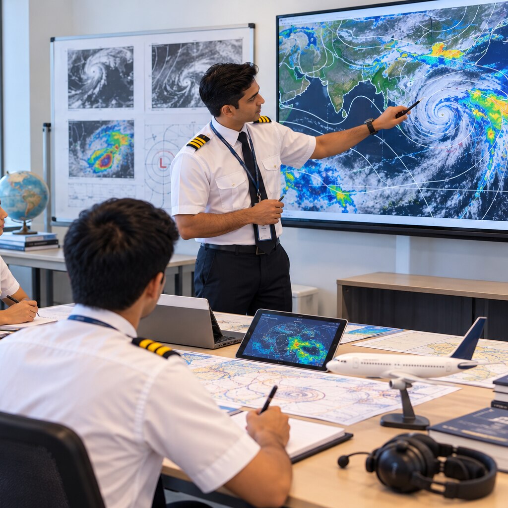
A pilot must turn changing atmospheric conditions into decisions about altitude, route, runway, fuel and diversion. By the end, you will be able to connect weather observations and forecasts with the specific risks they create during take-off, cruise, approach and landing.
Key takeaways
- Read METAR and TAF codes before making a departure decision.
- Connect temperature, pressure and moisture to aircraft performance.
- Use wind, visibility, cloud and storms to plan fuel and diversions.
- Treat weather interpretation as a core DGCA pilot-training skill.
What pilots actually study when they learn meteorology
An aircraft responds to air density, pressure, moisture and movement, not simply to whether the forecast says “good” or “bad.” In the Indian CPL pathway, DGCA meteorology training connects these conditions to aircraft performance, altitude control, route selection, fuel planning and diversion decisions.
- Pressure systems change wind, altimeter settings and density altitude. A 1-hectopascal setting error changes indicated altitude by about 27 to 30 feet near sea level; moving from high pressure to low pressure without correcting can leave the aircraft lower than indicated.
- Temperature and humidity determine air density. High temperature, high elevation and low pressure increase density altitude, producing longer take-off runs, weaker climb performance and reduced engine or propeller efficiency.
- Moisture appears through cloud types, visibility and precipitation. Icing needs visible moisture containing supercooled liquid water, so cold, clear air is not automatically an icing threat; cloud near the freezing level can be dangerous even when the surface is above 0°C.
| Atmospheric factor | Aircraft effect | Routine planning decision |
|---|---|---|
| Wind, fronts and jet streams | Alter track, groundspeed and fuel burn | Select headings, altitudes and fuel reserves |
| Thunderstorms and precipitation | Bring turbulence, lightning, hail and heavy rain | Avoid cells and reconsider the route |
| Turbulence and wind shear | Cause abrupt attitude, airspeed and altitude changes | Check advisories and runway approach risks |
| Visibility and cloud base | Restrict visual references and approach options | Confirm departure, destination and alternate minima |
Freezing-level data is only an estimate; compare it with cloud, precipitation, pilot reports and aircraft icing limitations.
How weather information becomes a pre-flight decision
A safe departure decision starts with the whole route, not the departure aerodrome alone. Check the planned departure time, destination, alternate, en-route weather, runway hazards and NOTAMs before deciding whether the flight remains practical.
1. Read the TAF for departure, destination and alternate airports. Note its validity period, wind, visibility, cloud, significant weather and temporary groups, then compare them with your operating and alternate minima.
2. Check the latest METAR at each aerodrome, followed by any SPECI. These observations show what is happening now, while the TAF describes what is expected; a favourable forecast does not cancel a deteriorating observation.
3. Examine winds and temperatures aloft, radar and satellite imagery, pilot reports, and SIGMETs along the route. Identify thunderstorms, heavy rain, icing, turbulence, wind shear and rapidly developing cells, especially during monsoon and pre-monsoon operations.
4. Compare time and location, not just the weather words. Ask whether the latest observation supports the forecast trend, whether the forecast period covers your arrival, and whether nearby reports reveal conditions the airport report misses. If evidence conflicts, delay, reroute or use the alternate rather than choosing the most convenient source.
A reported cloud base in a METAR is measured above aerodrome elevation, so add that elevation before comparing it with terrain or approach minima. Update the assessment immediately before departure; weather is a moving set of evidence, not a single pass-or-fail report.
How to read the codes that change a flight plan
A code changes a flight plan only after you identify what it measures, where it applies, and when it was issued. A METAR is a current observation at one aerodrome; a TAF is a forecast for that aerodrome and time period.
A SPECI is an unscheduled observation after a significant change, not a replacement for either product.
- Check the time, location and validity period before using any figure. AIRMET describes forecast moderate weather over a defined area; it is not a local observation.
- Read wind as the direction from which it comes. Wind 270° gives a headwind on a westbound track and a tailwind on an eastbound track.
- Separate visibility from RVR. Visibility describes general horizontal seeing distance; RVR describes runway-specific seeing of markings or lights. Use RVR for take-off or landing minima when reported.
- Decode cloud amounts precisely: BKN means broken cloud, covering five-eighths to seven-eighths of the sky, and it counts as a ceiling. OVC also counts; FEW and SCT do not. CAVOK means visibility of at least 10 kilometres, no significant weather, and no cloud below 5,000 feet or the applicable minimum sector altitude, whichever is higher. NSC means no significant cloud, but it does not guarantee excellent visibility.
- Treat a cloud height such as 008 as 800 feet above the aerodrome, not 800 feet above mean sea level. Add aerodrome elevation before comparing it with terrain or approach minima.
- Do not treat freezing level as the top of icing. Compare it with cloud, precipitation, pilot reports and aircraft icing limits; inversions and supercooled water can place icing outside the expected layer.
A pilot report adds local evidence, but it can be sparse or subjective. Compare it with observations, forecasts and advisories rather than allowing one report to decide the route alone.
How weather changes take-off, cruise and landing performance
A hot, high-elevation, low-pressure day produces high density altitude, reducing engine power, propeller efficiency and wing performance. Expect a longer take-off roll, poorer climb rate and higher true airspeed for the same indicated airspeed.
A headwind improves runway performance; a tailwind lengthens the ground roll and may require a different runway, lower take-off weight or a delay.
- During cruise, icing adds weight and drag while disrupting airflow over the wing, reducing lift and increasing stall speed. Avoid visible moisture near freezing temperatures; a reported freezing level does not prove that icing ends there, because supercooled water and temperature inversions can occur.
- During approach, poor visibility can require an instrument procedure or diversion. Cloud base is reported above aerodrome elevation, not mean sea level, so add the airport’s elevation before comparing it with terrain or approach minima.
- Near the runway, crosswind creates drift and demands corrective control. Wind shear can suddenly change airspeed, lift and descent path, making a go-around or rejected take-off the safer choice.
A METAR showing SCT cloud may leave a visual route open, but a CB or TS signals serious turbulence, lightning, hail and rapid wind changes. A VRB wind direction needs careful interpretation: wind is reported from its source, so 270° is a westerly wind.
Strong gusts, a tailwind component or wind shear can turn an acceptable landing into an unsafe one even when visibility and cloud base remain within limits.
Why weather interpretation is a core pilot-training skill
A trainee must turn weather data into a decision, not recite definitions. Thunderstorms can intensify between briefing and departure; a front can shift wind, cloud and visibility across the route; monsoon and pre-monsoon storms can add gust fronts, turbulence, heavy rain and water-covered runways. A static forecast can become unsuitable when the latest evidence changes.
Use each source for what it can actually tell you:
- Radar shows precipitation location, movement and intensity, helping identify developing cells and gaps that may close.
- Satellite imagery shows cloud growth and upper-level patterns beyond radar coverage, including approaching convective systems.
- Forecasts describe expected conditions and trends; read TEMPO, BECMG and PROB groups as changes within the stated validity period.
- Observations such as METAR and SPECI show what is happening at a specific aerodrome now; compare them with the TAF instead of treating either as definitive.
- Wind and temperature aloft reports reveal changing wind, temperature and density with height, while atmospheric theory explains fronts, stability, icing, turbulence and wind shear.
That comparison supports action: delay, reroute, change altitude, use an alternate or continue while monitoring updates. A pilot report can confirm local turbulence or hail, but sparse or subjective reports do not replace broader evidence.
SKYJET PILOT TRAINING ACADEMY can strengthen this skill by making trainees explain why each weather product changes a flight decision, rather than memorising code expansions for an examination.
Related product
 | DGCA - Ground School Aviation Meteorology Classes Aviation Meteorology Classes for DGCA CPL – Complete Training Guide At Skyjet Pilot Training Academy, Aviation Meteorology is not just a subject—it... |
Frequently asked questions
What do pilots study in aviation meteorology?
Pilots study pressure, temperature, air density, moisture, wind, visibility, clouds, turbulence, thunderstorms and weather systems.
How does weather information affect a pre-flight decision?
Pilots use forecasts and observations to assess departure conditions, route options, fuel needs, alternate airports and diversion triggers.
Which weather codes affect a flight plan?
METAR reports current aerodrome conditions, while TAF forecasts them; wind, visibility, cloud base, precipitation and thunderstorms can change the plan.
How does weather affect take-off, cruise and landing performance?
Temperature, pressure, wind, turbulence, icing, visibility and runway conditions influence aircraft performance and operational limits at every flight stage.